
Overview
Finding the Ghosts of K Road was a project produced for ADA Mesh Cities, Auckland 2014.
Local K Road historian Edward Bennett also contributed significantly to this work and donated his time to guide the walk and assist Tracey’s research leading up to ADA Mesh Cities.
There are a number of posts that discuss, document and share information about the Augmented Reality walk. You can check out:
- 365 Places: Karangahape Road
- The Tour: Auras for Finding the Ghosts of K Road
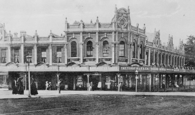
- Photo Essay of old K Road Buildings
- Augmented walking in the rain – documentation of the walk
- Presentation for the 365 Places: Karangahape Road
Proposal for ADA MESH Cities 2014, Auckland: Guided tour and presentation
An Augmented Reality Project by Tracey Benson
Background
Finding the Ghosts of K Road combines a guided walk around a famous street in the city of Auckland with the use of augmented reality. This work has been created to explore the site of Auckland as a potential tourist, seeking to build knowledge of the place from afar – past journeys and memories, present events, spaces, places and histories.

The work is a guided walk around a central area of Auckland, along a section of K Road, a well-known road for its historic buildings and controversial past as a red light district.
Link to map: https://mapsengine.google.com/map/edit?mid=zCKxBwSpOmyo.khOZVdfjJIzw
By attending the walk, participants can discover some ghostly relics of buildings along a section of K Road. This is achieved by downloading and using an app for Internet enabled hand-held devices – smart phones and tablets. The accompanying guide will help the audience (tourist) to explore the city through the eyes of a stranger. As both tour guide and tourist, it will be a journey of discovery for both artist and audience, which is intended to build knowledge of the past of K Road while engaging with its present form.
K Road’s story ties closely to Maori culture:
According to Maori oral tradition and mythology Hape was an ancient Maori ancestor who travelled from Rarotonga on the back of a stingray arriving on the shores of Mangere. Hape greeted the Tainui waka on its arrival with a ‘karanga’ or greeting – hence “karangahape”. Karangahape is also said to mean “a winding ridge of human activity”.
(Heritage Walk, Karangahape Road (2012) PDF)
Finding the Ghosts of K Road builds on a previous project developed for ADA Mesh Cities in 2013 titled Walks of Absent Memory, where the focus was on Dunedin’s urban architectural past. As part of the project for ADA Mesh Cities 2014, I will attend the conference and take people around the walk on a guided tour, rather than engaging remotely via Skype.
In Finding the Ghosts of K Road there are connections to my ongoing interest in my childhood suburb of Aspley: which has been the focus of past projects exploring place, history, the body and environmental impact. In this post about Scalpland and the history of Aspley, layers of history are revealed, including that some of the main arterial roads were Aboriginal tracks before European occupation.
One of my friends in Aotearoa sent me this interesting YouTube clip featuring historian Edward Bennett talking about Karangahape Road.
Stay tuned for the next stages of this project.
References
K Road Heritage http://www.kroad.com/heritage/ (accessed 15 August 2015)
K Road, The Meaning of Karangahape (accessed 12 August 2014)
Long White Kid, May 2014 Archives (accessed 12 August 2014)
Short Walks in Auckland http://walksinauckland.com/karangahape-road-parks/ (accessed 15 August 2015)
ADA Symposium page http://www.ada.net.nz/symposia/symposium2014-symposia/tracey-benson/

Leave a comment